STOP PRESS: It has been pointed out that the post entitled "Freezing and the Frisian Islands. Scheveningen, IJmuiden and Oudeschild" contained a grammatical error. The author of the blog wishes to convey his sincere apologies for this and to assure said complainant (Philippa) that his proof reader has been suitably punished. We trust that this swift and decisive action provides sufficient redress.
Now. Where
were I?
Oh yes.
Vlieland our next destination?
Well, that was the plan but the wind had other ideas - remaining determinedly strong and from the north!
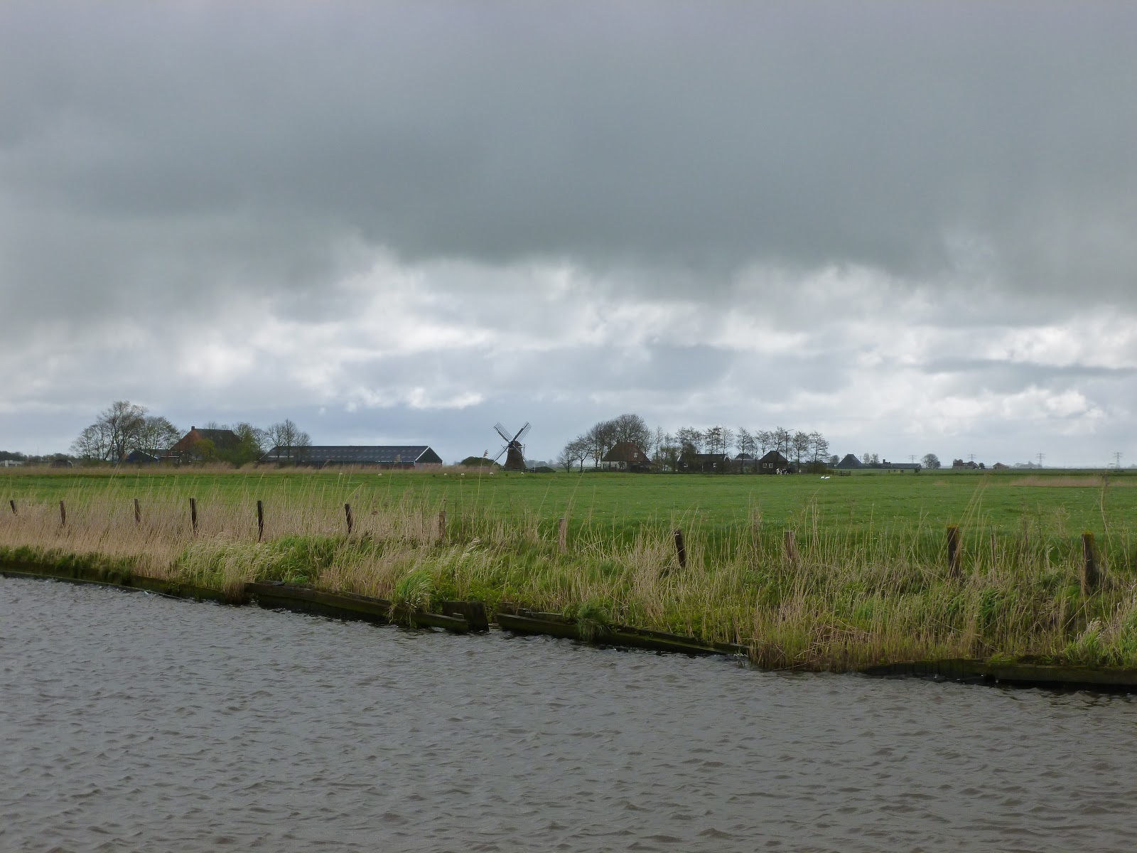
So, rather than stay in Oudeschild for a few more days, we decided to head for Harlingen where we could take the canals to Lauwersoog. It meant motoring (from Harlingen), but at least we would keep moving.
The sail across the Waddenzee to Harlingen was notable for a squall which dumped rain and winds of 30 knots on us shortly after leaving Oudeschild. Once the weather had got that out of its system, however, fair winds enabled fast and civilised sailing.
The only problem was that we couldn't afford to reach the last part of the Boontjes channel - not far from Harlingen - before 1700 (or so we thought) because there wouldn't be enough depth for us before then.
So we kept reducing sail and reducing sail to slow the boat down until I had just the genoa flying with 2 reefs in it!
When we got to the Boontjes channel it had clearly been dredged as there was far more depth than charted...
 |
| The IJsselmeer is behind that dam. Impressive stuff! |
 |
| Harlingen from the Boontjes channel |
 |
| Part of the "brown armada" viewed from the entrance to Harlingen |
We elected to pass through the Tsjerk Hiddessluis and moor at the HWSV marina for a couple of nights. I'd called the harbourmaster there before leaving Oudeschild as I was concerned about the available depth. I told him our draught was 1.70 metres and asked him what the depth was in the marina. 1.70 metres he declared. You'll be fine! And we were. Just!
 |
| Inside the Tsjerk Hiddessluis. Nice lock. Loads to tie or hang on to! |
 |
| Cyclone in her first box mooring of the trip. Facing someone's back garden! |
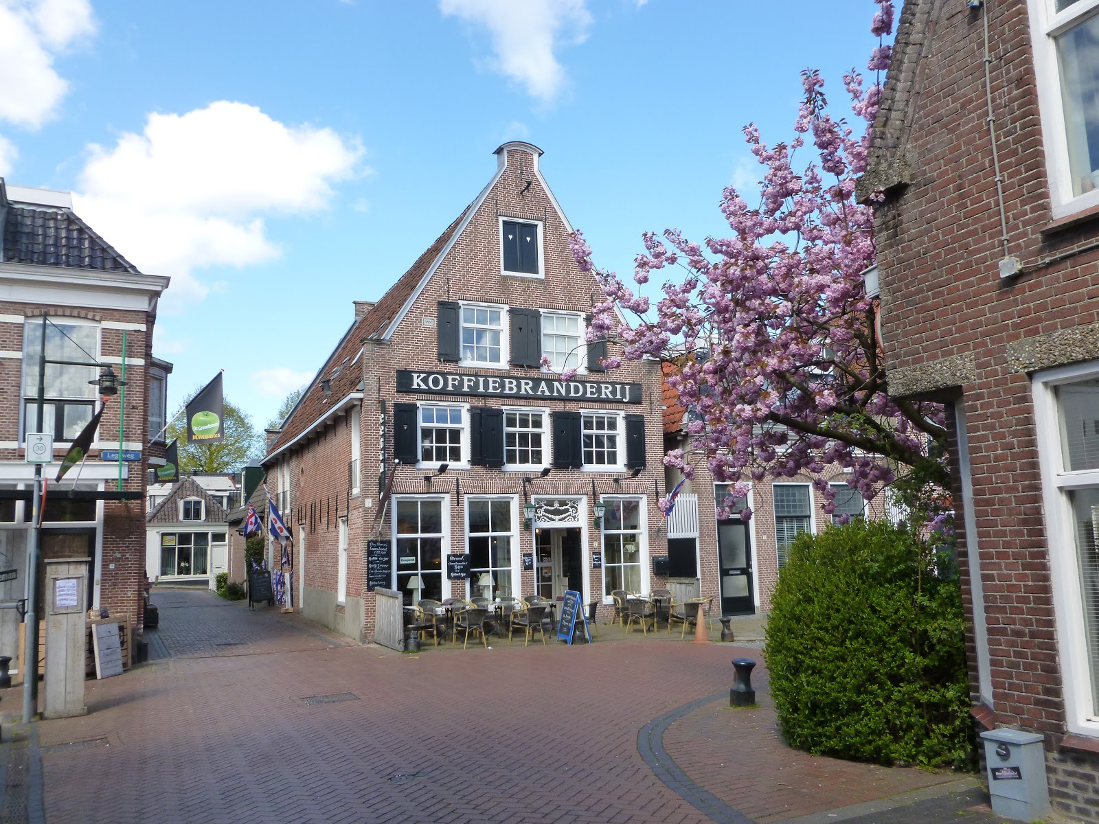
The next day was spent walking around Harlingen and doing some shopping. Oh, and losing my credit card.
Just before leaving the UK I'd heard about a credit card from Revolut that you control using an Android App. The app enables you to top it up (it's a prepaid card), keep a check on spending and, of particular relevance here, disable the card if you should be daft enough to lose it. So disable it I did.
I then walked back to the supermarket where we'd been shopping, annoyed a queue of customers when the assistant I spoke to diverted the person serving them to search for my card, and returned empty handed to Cyclone. Where Jo had located the card.
Fortunately the app allows you to enable the card too, should you find it again!
Anyway, some pictures of Harlingen:
 |
| Which form of transport today, sir? |
 |
| A fat bloke impersonating a goofy lion. I had lots of stuff in my pockets. Really!! |
 |
| The Noorderhaven. Marina in the centre of Harlingen |
 |
| More of the "brown armada" |
 |
| The Zuiderhaven, Harlingen |
 |
| Old and new. A modern ship through the ranks of old timers |
 |
| Artistic shot (ish) of the Zuiderhaven |
 |
| Catholic church in Harlingen |
 |
| Characterful canal side property |
 |
| Posh old hotel building |
 |
| 'Nuff said! |
From Harlingen we motored through the canals past Leeuwarden, the capital of Friesland, to Dokkum. Once again we were treated to some bitterly cold wind and squally showers. Sunglasses were necessary to protect eyes from hail rather than the sun! So it was nice to tie up against the canal side (on our second attempt. Our first saw us stranded on the bottom, 6 feet from the bank!).
 |
| View on the Van Harinxmakanaal... |
 |
| ... and another... |
 |
| ... and another. How Dutch is that?! |
 |
| Fly swatter bridge near Leeuwarden |
 |
| Leeuwarden centre |
 |
| Leaning Oldehove tower of a cathedral which was never completed. Leeuwarden |
 |
| We saw a lot of these on the Dukkumer EE... No idea what's meant to live in them |
 |
| There are some lovely canal side properties... |
 |
| Opening bridge at Burdaard |
 |
| Dokkum from Cyclone's bow |
 |
| One of 2 working windmills at Dokkum |
 |
| More pictures of Dokkum. Pretty ain't it? |
 |
| And more... |
 |
| ... and more... |
 |
| ... and more |
The province of Friesland is known for its Eleven Towns race, an ice skating tour on natural ice about 200kms long, passing through the 11 towns of Friesland. Dokkum is the 11th town of the tour and after receiving their stamp at De Zijl in Dokkum, the skaters turn around to start the final stage of the tour to Leeuwarden. The benches on the waterside at the turning point are shaped like Frisian skates and point in the direction the skaters should go.
 |
| Skate shaped bench |
 |
| Another shot of Dokkum... |
 |
| ... and another |
Saint Boniface was an important bloke in these parts but, according to the lovely lady in the tourist information office, "Not everybody liked him. They killed him." 25,000 to 40,000 pilgrims visit Dokkum every year apparently, so he must be good for business. Maybe they like him now?!
 |
| St. Boniface's chapel, built in 1934 |
 |
| Flotilla, Dutch style. Waiting for the lifting bridge in Dokkum |
The second day of our visit to Dokkum was King's day. Now we're not really sure what that entails, but it's a public holiday so no doubt it's very popular. One tradition is for kids to set up stalls with their unwanted clothes and toys to sell in the city centre. Seems a good idea to me. Better than landfill!
Another tradition in Dokkum is the duck race. We sponsored a duck, but it didn't win. Mind you, looking at the picture below, I don't think the odds were very good!
 |
| Duck race Dokkum. Not sure which one ours is. |
 |
| Come on number 001638! |
 |
| And the winner is.... Not 001638 apparently |
We were fortunate to meet a couple of Australians in Dokkum - Phil and Maree of Red Roo. They are also sailing to the Baltic and joined us for a few drinks and a hastily assembled pasta bolognese. It turned into a fine evening, enjoyed by all! We'll no doubt see more of them as we're heading in the same direction once we get to the Baltic Sea.
With a forecast of strong easterly winds for at least a week from Saturday evening, we decided to set off for the Kiel Canal on Friday morning (28th April). At nearly 150 nautical miles, this would be the longest trip we'd ever done and I think it's fair to say we weren't especially looking forward to it.
So, once again, our original plan - to call into Norderney - had to be replaced by another. It must be so much easier with a caravan Tim!
0930 on Friday morning saw us leave the canal side at Dokkum. 1045 saw the closure of the Nieuwe Sluis (a lock) just as we approached it "for about 1.5 hours" whilst some maintenance work was carried out. Fortunately after 30 minutes the lock keeper called us on the radio and said we could lock through. His change of heart was very welcome as we needed to take on fuel just the other side of the lock and the fuel berth would shut for lunch from 1200 to 1300!
After refuelling we continued along the canal to the Lauwersmeer, a large lake created by the construction of a dam separating it from the sea. Parts of this are very shallow and we ploughed a 50m furrow in the bottom with our keel as we crossed it! It was very gentle; we only knew we'd touched the bottom because our speed had dropped from 5 to 2 knots!
 |
| The Lauwersmeer |
 |
| Traditional sailing craft on the Lauwersmeer |
Then, at 1330, it was through the sea lock at Lauwersoog and into the North Sea once more.
 |
| Leaving the lock at Lauwersoog |
 |
| Strange place for a shed! |
The sands in the entrance channel to Lauwersoog move regularly and the buoys are continually being re-positioned to show where the deepest water is. With 20 knots blowing against the ebb tide, conditions in the channel were horrible, with large cresting waves lifting us up before dumping us unceremoniously 3 or 4 metres into a trough. We were making less than 2 knots through that lot directly into the wind under power but, thankfully, the tide was behind us and we cleared the worst bit in about half an hour. Then it was simply a case of turn right, get those sails drawing, and wait. For quite a while. We had about 85 miles to go before the entrance to the Elbe. That's about 17 hours at the 5 knots we use for passage planning.
The sea state was nothing like that in the Lauwersoog channel and we settled down to a fast, if slightly rolly, sail. Unsurprisingly, it got dark. This hardly mattered as there's nothing to see in any case. Anything we might manage to hit should have a light on it - albeit usually a pretty dim one.
So on and on we sailed, getting faster and faster as the tide turned in our favour. Far too fast as it happens, as we were planning (at 5 knots remember?) to reach the entrance to the Elbe at 1000, at which point the tide would whisk us nicely the 40 remaining miles to Brunsbuttel in the Kiel Canal.
There are dire warnings about being in the Elbe estuary during a wind against tide situation (which we would have until 1000) and, with the experience of Lauwersoog's channel still very much in our minds, we were a tad apprehensive about this, So we rolled away the head sail to try and slow down. Cyclone had other ideas, however, and just bounded along regardless.
So, with yet another bit of planning by the wayside, we arrived at the Elbe entrance no less than 5 hours too early! This meant plugging the tide (the sea state was fine, despite the warnings) as far as Cuxhaven - some 25 miles - with speeds as low as 2 knots over the ground! Then the tide turned on a sixpence and we were whisked the final 15 miles to the Kiel Canal at up to 9 knots!
 |
| Pretty? Maybe, but likely to mean rain and squally winds |
 |
| Sun rise over the Elbe |
 |
| Entering the Kiel Canal. That's a long step down for short legs, eh Jo?! |
So, at 1430 Saturday afternoon, 146.1 miles and just 29 hours after leaving Dokkum, we tied up alongside at Brunsbuttel. That's an average of just over 5 knots - not bad as it includes waiting for bridges, 3 locks, deliberately slowing the boat down and a refuelling stop!
 |
| Alongside at Brunsbuttel watching the ships exiting the lock. Big, aren't they? |
I think it's fair to say that we were a bit tired, but we still managed a shower, a bite to eat, and a glass of wine before finally crashing out soon after 2100. We're civilised like that!
This morning we were woken at 0530 by a bloke from the boat that had tied alongside us crashing across our decks - and back again - to go to the loo (I assume). Then again at about 0730 as the 2 of them crashed across - and back again - to have showers (I'm guessing). Then again - maybe to visit the bakery? Before making numerous trips to disconnect power and lines before finally departing at about 0830.
I now feel like I'm about 80 - sleep deprivation, the cold and an unstable platform for 29 hours do that to you!
Ah the pleasures of boating...


2 comments:
Phew, wow and triple wow! (Really must buy a thesaurus.) 29 hours at the helm or did the Captain's mate take over for a spell or two? Good job you don't need tachograph card for cruising.
Do I assume Jo's maiden name was Butler? It would explain the chicken butler photo. Or is she your butler?!
Fantastic blog and pix as usual. I nearly had to go and lie down for a rest after reading your last entry.
Carry on Cruising!
Tim, Catherine and Abigail
Nice places, for uss well known. The kieler lock is closed already for 3 years for leusure ships. And it will take another few years before we can use it. The government will not give money for this lock!!!!
Marjolein and Alfred.
Post a Comment