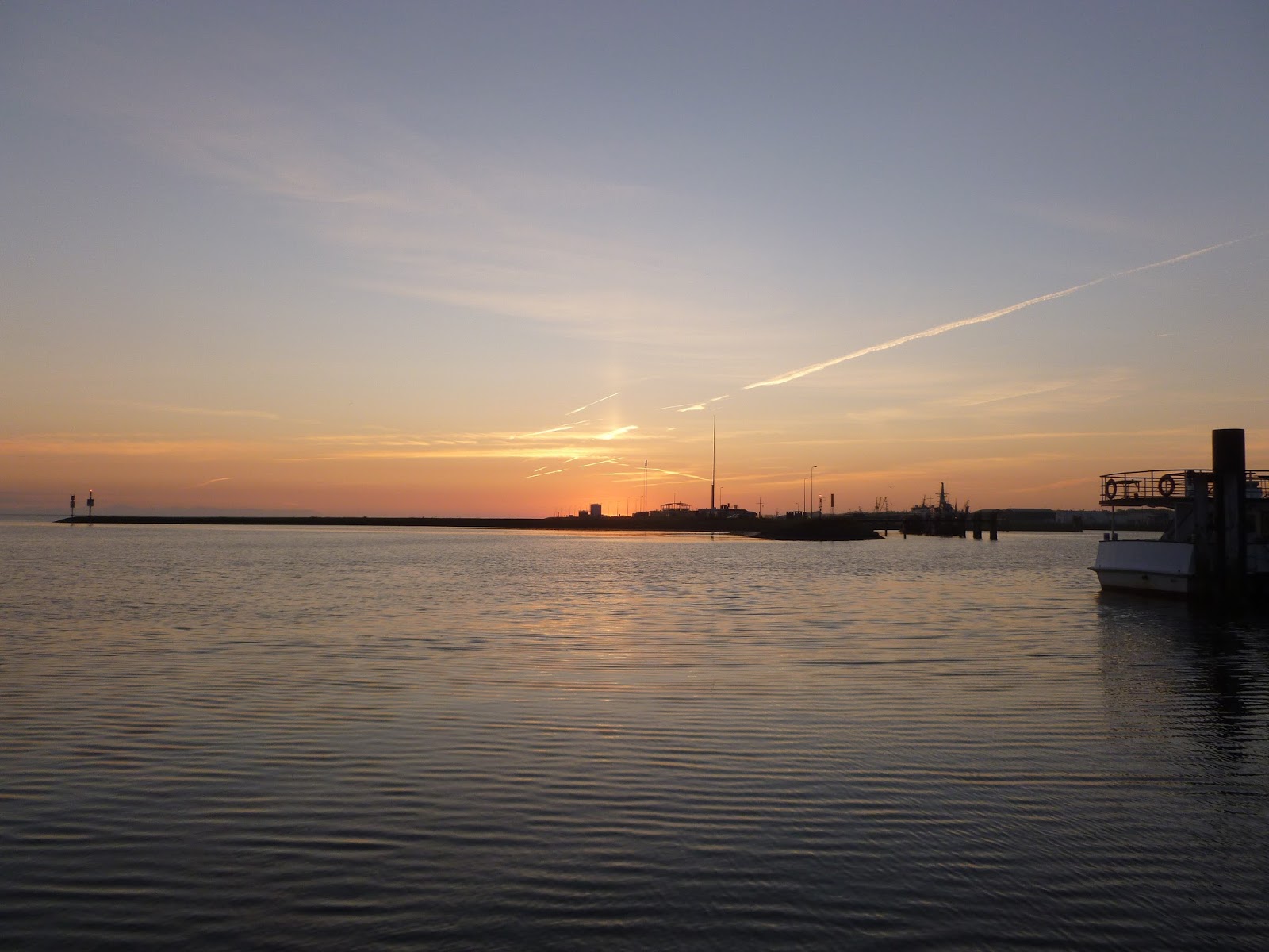
Cuxhaven has a reputation for trapping yachts. The problem is that strong winds blowing against the rapid ebb tide create dangerous seas in the entrance to the River Elbe. What you want are moderate winds from the east. What we got - for over a week - were strong to gale force winds from the west or north west! Ho hum...
 |
| National flags flown at the marina. |
 |
| A, er, knitted bicycle |
 |
| Wind break basket things on Cuxhaven's prom. Do they move around at night? |
 |
| Cuxhaven's Kugelbake. Iconic old navigational mark |
 |
| Duck racing venue at Cuxhaven's Buttfest |
We finally escaped from Cuxhaven on Tuesday 8th September at 0940. Having been there since the previous Sunday we wanted to make up for lost time, so we headed for Lauwersoog in the Netherlands. This was quite a distance - some 115 Nm (132 land miles) - and was therefore going to take us some time. After an extended period of strong winds and gales, it was a bit galling that there was insufficient wind for us to make decent progress under sail power alone. By motor-sailing, however, we made good time and arrived west of the Frisian island of Schiermonnikoog, where the channel to Lauwersoog begins, by about 0400 Wednesday.
In one way that was great, but in another it wasn't. I'd expected it to be daylight by the time we had to face the approach channel which, whilst well marked with lit buoys, is more than a little convoluted. To complicate matters, our chartplotter's chart is out of date (we knew that - it's 2011) and the information on our Navionics chartplotter App, for which we'd downloaded updates at the weekend, also proved inaccurate. We therefore took it very slowly, careful to identify each pair of red and green buoys positively before inching forward. This "inching" wasn't helped by a 2 knot following tide. I'd normally be very grateful for that!
We arrived at the Lauwersoog lock at 0615 Wednesday and waited until 0715 to lock in.
 |
| Maintenance vessel in the River Elbe tied to a navigational mark |
 |
| Sunrise while waiting for the lock at Lauwersoog |
 |
| This is what you feel like after more than 20 hours at sea with little sleep! |
We finally tied up at the Noordergat marina at about 0730 and, having showered and paid the harbourmaster, got to bed soon after 0930. Up bright and breezy by 1300 (yeh, right!) we went for a walk around Lauwersoog. That didn't take long as it's not very big so we decided to press on the following day
.
 |
| Traditional boats - if not colours? - moored at Lauwersoog |
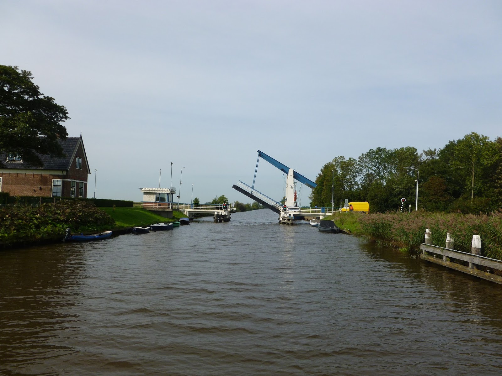
We'd intended to be on the move by 0800 but didn't wake up until 0930 so set off a bit later! Before reaching the the canal proper, we crossed the Lauwersmeer, which is now a shallow inland lake. Sticking carefully to the buoyed channels, we still recorded depths of a shade less than 2m in places, which doesn't leave much clearance under our 1.7m deep keel. Once in the canal, the depth was a pretty consistent 2.2m and we soon settled to a relaxed and very pleasant meander through the Friesland countryside.
Now the Netherlands is quite flat which, where canals are concerned, is brilliant. A flat world means very few locks are required, so there's none of the Gota Canal's 58 locks to cover 103Nm nonsense! Instead, we had to negotiate just one lock - a gentle one at that - on our first day's trip of 27Nm to Leeuwarden, and it was 38 miles after that before we encountered another. Marvellous!
 |
| There are a lot of these. All opened promptly as we approached..... |
 |
| ..... except at lunchtime! Jo's not used to stopping for lunch |
 |
| Most of the canalside scenery is beautiful, but not all... |
 |
| Our first proper windmill! |
 |
| Bridge operator collects toll in clog suspended from fishing rod. I'm not kidding! |
 |
| Canalside view... |
 |
| ...and another |
 |
| ...and another |
 |
| ...and another |
 |
| I said it was flat! |
We saw this from a distance as a huge sail traversing the countryside. I have to say we were mighty impressed as we watched it negotiating the canal under sail alone.
 |
| Respect! |
 |
| What a great sight |
 |
| Thatch is seen quite often, but the combination with tiles seems a bit strange |
 |
| A house in a haystack! |
Just outside Leeuwarden we encountered a further delay as the bridges don't open between 1600 and 1800 - presumably to enable rush hour traffic to continue unhindered. This proved fortuitous as we met up with Vim (the Dutch contraction of William) and Harriet who were waiting at the same bridge. They not only proved to be very good company over a glass of wine later that evening, but also gave us some good tips and information.
When I recounted my experience of the Lauwersoog entrance channel, Vim advised me that it changes every 2 weeks or so at the moment because of the shifting sands! I can't really blame Navionics then....
Vim also suggested that we head for Stavoren on the IJsselmeer rather than our intended destination of Lemmer, as this would provide a more interesting route with greater sailing opportunities. We took that advice and were glad we did. Finally, Vim pointed out that part of the standing mast route south of Leeuwarden had altered with the creation of a new aqueduct - something that wasn't reflected on my 2011 chartplotter chart! This was no problem once brought to my attention as we had an up to date paper chart for the area. It looked a bit strange crossing the land on the chartplotter though!
 |
| Waiting for the bridge at Leeuwarden. Notice the canalside trees? |
 |
| We didn't until we were moored with our mast between branches! |
 |
| Steam engined boat, The air duct and chimney were removed to pass under the bridge! |
 |
| Our berth in Leeuwarden... |
 |
| ... and again after everyone else had left |
We stayed 2 nights in Leeuwarden, which is the capital of Friesland. It's a really attractive place and, equipped with information from the tourist office, I took Jo on one of my walking tours - something she has learned to dread.
Now as far as I'm concerned, if it's on the tour, you visit it. You don't have to go in of course, assuming that's even an option, but you do have to find it. Jo takes a different view. She has been heard to mutter that the fact that someone we've never heard of once did something fairly insignificant on a particular spot is insufficient grounds for a detour. Girls, eh?!
Well, it's good exercise anyway....
 |
| Leaning cathedral tower. They never built the rest |
 |
| Leeuwarden shopping street |
 |
| Traditional craft moored canalside in Leeuwarden |
 |
| No idea who this is, but he'll need bigger wings if he hopes to fly |
 |
| De Waag. Renaissance weighing house |
 |
| Yup! |
 |
| One of many attractive buildings in Leeuwarden - on walking tour |
 |
| Naauw - Leeuwarden |
 |
| Bierkelders - The beer harbour and centre of beer trading |
 |
| Fed-up man in bath. Someone's idea of "art" |
 |
| Paddleboarders. Loads of 'em! |
After our 2 nights at Leeuwarden, we set off towards Stavoren on the banks of the IJsselmeer. We didn't have a plan of where to stop, but hoped to moor at one of the free canalside moorings. That's the beauty of the canals; there're plenty of opportunities to stop.
 |
| Fly swatter bridge. Leaving Leeuwarden |
 |
| Commercial traffic on Prinses Margriet Kanaal |
The absence of locks and the efficiency of the bridge openings meant that we made good progress and stopped for the night at a marina near Stavoren itself. From there it was a short sail across the IJsselmeer to Enkhuizen, where we're currently berthed in the Compagnieshaven.
 |
| Traditional sailing craft abound here. This one's pictured from our marina berth |
 |
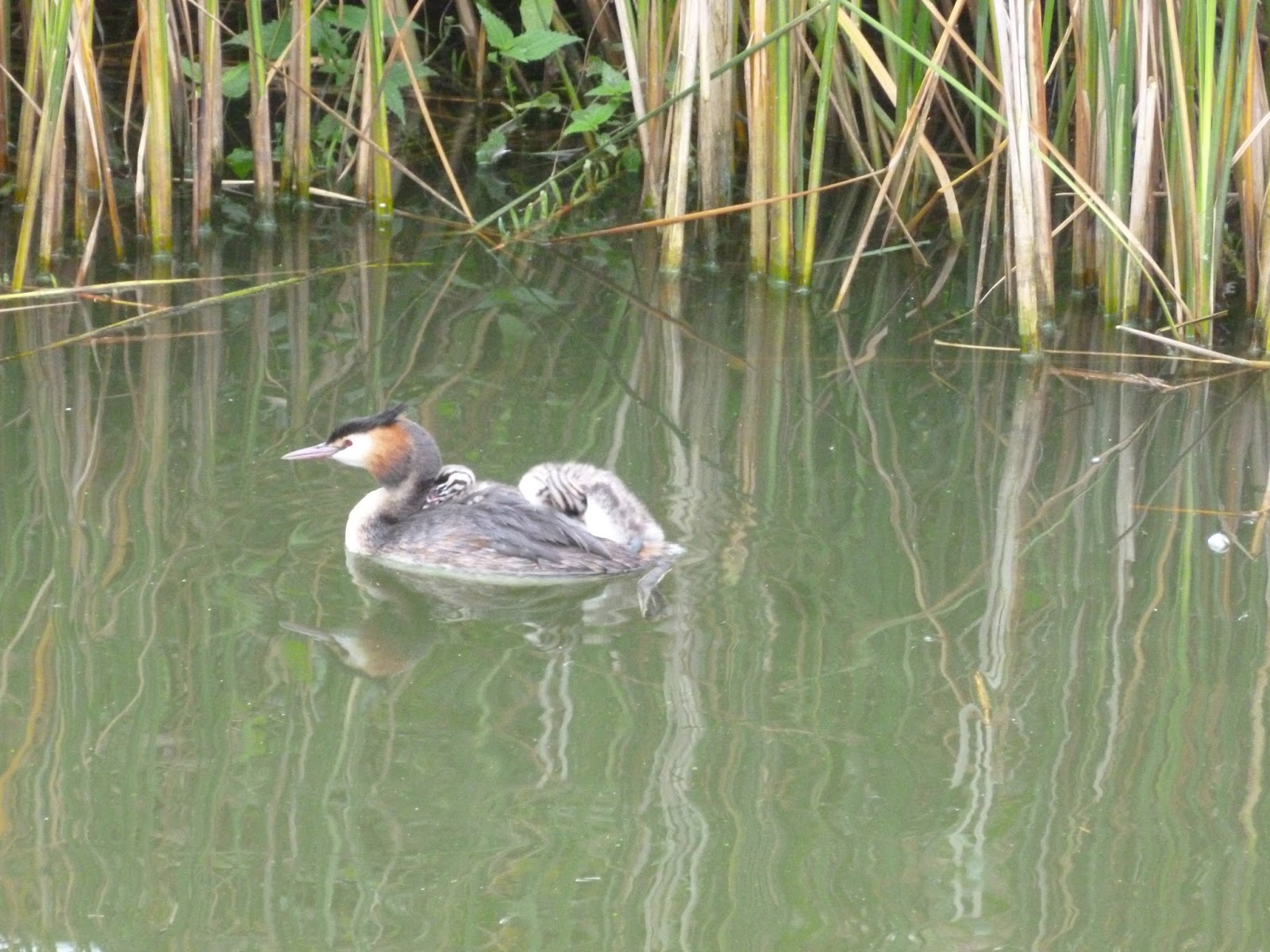
| Look closely and you'll see the 2 chicks on this Great Crested Grebe's back. Also taken from our berth |
Enkhuizen was one of the harbour towns of the VOC, the Dutch East India Company, and its former wealth is evident from its many impressive buildings and monuments. It's also home to the Zuiderzeemuseum - a massive undertaking which needs a whole day to explore.
The Zuidersee used to be the economic centre of the region and a link to the North Sea. Merchants used to trade from here with ports in the Baltic, Southern Europe, Asia and South America. Fishing villages exploited the rich fishing grounds. However, storm surges and floods swallowed up land, houses, inhabitants and livestock, causing enormous economic damage.
In 1918 the decision was taken to tame the Zuiderzee and, in 1932, the Afsluitdijk was completed. This closed off the Zuiderzee from the North Sea. The inland sea created by it was called the IJsselmeer and the part outside the dyke became the Waddenzee.
This drastically changed the lives of those living in the area. Fisherman had to seek other work and many businesses that served the fishing fleets vanished.
The Zuiderzee culture was disappearing and, in 1948, the Zuiderzeemuseum was founded to preserve its history. Since then, houses and company buildings have been gathered from the region and rebuilt to create an outdoor museum to complement the indoor one. The first building to be brought here was a chapel from Den Oever in 1967 and the outdoor museum was opened by Queen Beatrix in 1983. There are now 140 buildings in the museum, creating a fishing village, polder, town canal, church quarter and harbour. A visit is a must if you're ever nearby. The pictures below will give you an idea of what you'll see if you do.
 |
| Locals in traditional dress. Or are they?!! |
 |
| Harbour. A scaled down version of the one at Marken |
 |
| Shop interior |
 |
| Butchers shop interior. Great tiling |
 |
| There was one of these outside each pharmacist's! Say ahh |
 |
| Boatbuilder's workshop |
 |
| Fishing net production and knitting |
 |
| Goats sheltering from the thunderstorm! |
But the piece de resistance has to be the washing machine (well, alright, the laundry).
First take your steam engine to power it:
Then connect that by a series of belts to your woollen washer (the barrel in the picture below agitates up and down) and washing machine for other fabrics (the thing behind it).
Then drive the rinser and mangle from the same belt driven shaft:
 |
| Rinser and mangle |
 |
| The washing machine in its full glory - and all working during our visit |
Finally, some pictures from around Enkuizen itself:
 |
| It'really is a bit wonky |
The winds are currently gusting to over 40 knots but are supposed to die down later. Hopefully they will as we'd like to travel the 30Nm to Amsterdam tomorrow.
Thanks for reading.


6 comments:
If its on the tour....you visit it..them's the rules..
Exactly! Thank you Ashley.
Hi guys,
We really enjoy your posts. We are actually on the same route as you, albeit some weeks behind. We are currently in Fyn in southern Denmark, having done Sweden, Gota Canal and much of Denmark over the last 5 months on our boat.
Your posts about travel from Kiel to Amsterdam are really interesting as again we are looking at doing the same route as you. Could we ask you a couple of questions:
- our schedule means we will probably arrive in Cuxhaven mid October. Do you see any problems with the weather being an issue at that time of year?
- are there any publications or information sources you would especially recommend?
- are there any legal docs we might not have thought about for travel through those countries?
These and any other tips you could give us would be really appreciated!
It's a shame we are both covering so much of the same ground but never have had the chance to meet up.
We are planning on travelling further south through the canals (mast off) to end up in the Med late spring. What are your upcoming plans.
Thanks so much!
Liam and Malene
Bail
Thanks Liam. ANWB App is good for the Netherlands canals. You should have an ATIS enabled VHF and check your insurance covers inland waterways - mine didn't. Also, more maintenance work is done on the canals later in the year I understand, so there may be delays. Canal closed currently at Alphen a/d Rijn so you need to exit at IJmuiden and go south via the North Sea. See www.varendoejesamen.nl/nieuws/stremming-staande-mast-route-alphen-aan-den-rijn. As for weather, well October is a windy month but then it's been windy for a while off and on. Finally, check marinas are still open later in the year! Cheers, Rob
Thanks Rob, do you know the easiest way to get ATIS enabled?
Cheers
Liam
For British registered boats you can apply online to Ofcom for an ATIS number (they also allocate MMSI numbers). You then need to program this into your VHF. Not all can be user programmed. Some need to be sent to the manufacturers and maybe some aren't ATIS compatible at all. You'll need to do some googling! We hardly used our VHF as the bridge operators keep a good lookout. Ultimately it's between you and your conscience whether you bother.
Post a Comment